Difference between revisions of "File:OS Kidderminster 1924 2.jpg"
From SVR Wiki
(Extract from the OS 25 inch map of Kidderminster published in 1924, showing the continuation of the Kidderminster and Stourport Electric Tramway "Tramway no. 2" from Kidderminster Station to the terminus at the Junction of Comberton Road and Somerleyto...) |
(No difference)
|
Latest revision as of 15:14, 22 November 2021
Summary
Extract from the OSOrdnance Survey 25 inch map of Kidderminster published in 1924, showing the continuation of the Kidderminster and Stourport Electric Tramway "Tramway no. 2" from Kidderminster Station to the terminus at the Junction of Comberton Road and Somerleyton Road.
Licencing
This image is derived from an original Ordnance Survey Map held on the National Library of Scotland Map Images Website.
Reproduced with the permission of the National Library of Scotland under the terms of the Creative Commons Attribution-NonCommercial-ShareAlike (CC-BY-NC-SA) licence.
File history
Click on a date/time to view the file as it appeared at that time.
| Date/Time | Thumbnail | Dimensions | User | Comment | |
|---|---|---|---|---|---|
| current | 15:14, 22 November 2021 | 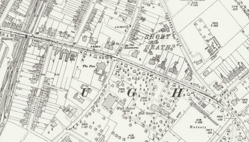 | 864 × 492 (128 KB) | Robin (talk | contribs) | Extract from the OS 25 inch map of Kidderminster published in 1924, showing the continuation of the Kidderminster and Stourport Electric Tramway "Tramway no. 2" from Kidderminster Station to the terminus at the Junction of Comberton Road and Somerleyto... |
- You cannot overwrite this file.
File usage
The following page links to this file: