Difference between revisions of "Foot crossing at milepost 145"
From SVR Wiki
(create page for crossing at milepost 145) |
(typo) |
||
| Line 1: | Line 1: | ||
[[File: Crossing_17_20150528a.jpg|thumb|300px|right| Location of milepost 145 seen from the Cycle Route]] | [[File: Crossing_17_20150528a.jpg|thumb|300px|right| Location of milepost 145 seen from the Cycle Route]] | ||
[[File: Crossing_17_20150528b.jpg|thumb|300px|right| The crossing]] | [[File: Crossing_17_20150528b.jpg|thumb|300px|right| The crossing]] | ||
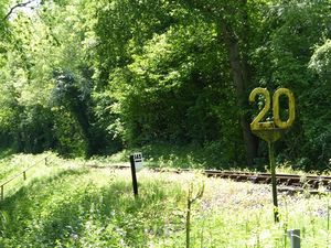
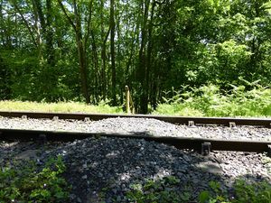
| − | At milepost | + | At milepost 145, just a few yards south of the [[Farm crossing near milepost 145 | farm crossing]], a stile on [[National Cycle Route 45]] and a wooden handrail leads to a small stone crossing. The Ordnance Survey map suggests there is a public footpath at this location. |
==See also== | ==See also== | ||
Latest revision as of 18:16, 1 May 2016
At milepost 145, just a few yards south of the farm crossing, a stile on National Cycle Route 45 and a wooden handrail leads to a small stone crossing. The Ordnance Survey map suggests there is a public footpath at this location.
See also
Towards Kidderminster
List of infrastructure
Towards Bridgnorth

