File:Rifle Range OS Map.jpg
From SVR Wiki

No higher resolution available.
Rifle_Range_OS_Map.jpg (683 × 549 pixels, file size: 153 KB, MIME type: image/jpeg)
Extract from the Ordnance Survey Map of 1888-1913 showing the location of the Rifle Range near Bewdley. (Crown Copyright reserved)
File history
Click on a date/time to view the file as it appeared at that time.
| Date/Time | Thumbnail | Dimensions | User | Comment | |
|---|---|---|---|---|---|
| current | 12:02, 13 December 2015 | | 683 × 549 (153 KB) | Danny252 (talk | contribs) | Change map to 1888-1929 map, which shows halt |
| 15:23, 30 June 2015 | 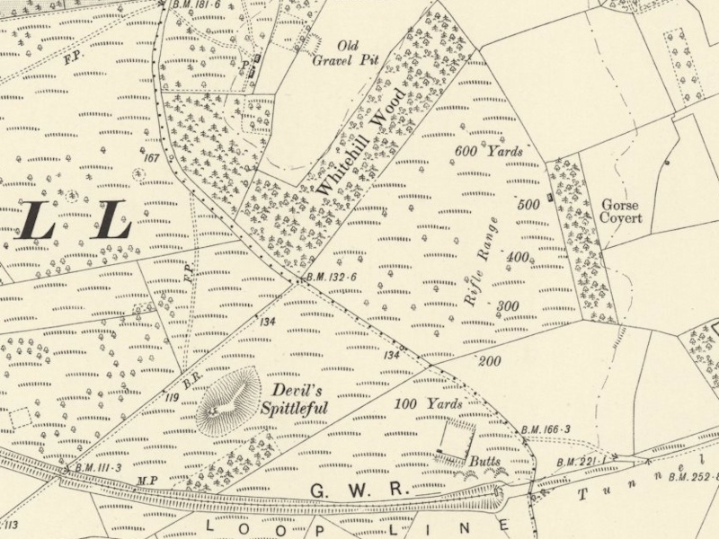 | 800 × 600 (231 KB) | Robin (talk | contribs) | Extract from the Ordnance Survey Map of 1888-1913 showing the location of the Rifle Range near Bewdley. (Crown Copyright reserved) |
- You cannot overwrite this file.
File usage
The following page links to this file: