File:OS Summerfield Siding 1955.jpg

Summary
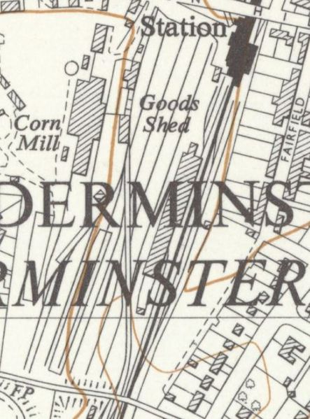
Excerpt from OSOrdnance Survey 1:10,000 Map SO87NW - A (includes: Churchill and Blakedown; Kidderminster Borough), Surveyed / Revised: 1949 to 1955, Published: 1955, showing the top yard at Kidderminster. Although less detail is shown than earlier 25in maps, the position of Summerfield Siding built in 1943 can be made out. The security fence around it starts just under the letter 'R' next to J.P. Harvey's Corn Mill. Immediately to its left is a third private siding for Harvey's built at the same time.
Licencing
This image is derived from an original Ordnance Survey Map held on the National Library of Scotland Map Images Website.
Reproduced with the permission of the National Library of Scotland under the terms of the Creative Commons Attribution-NonCommercial-ShareAlike (CC-BY-NC-SA) licence.
File history
Click on a date/time to view the file as it appeared at that time.
| Date/Time | Thumbnail | Dimensions | User | Comment | |
|---|---|---|---|---|---|
| current | 16:37, 21 May 2021 | | 547 × 740 (92 KB) | Robin (talk | contribs) | Excerpt from OS 1:10,000 Map SO87NW - A (includes: Churchill and Blakedown; Kidderminster Borough), Surveyed / Revised: 1949 to 1955, Published: 1955, showing the top yard at Kidderminster. Although less detail is shown than earlier 25in maps, the posi... |
- You cannot overwrite this file.
File usage
The following page links to this file: