File:OS Buildwas 1882.jpg
Summary
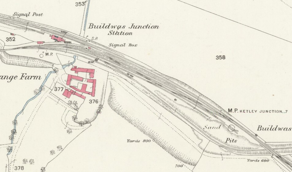
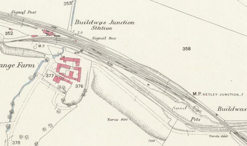
Extract from the OSOrdnance Survey 25 inch map of Shropshire XLIII.13, surveyed 1882, published 1883, showing the layout of Buildwas station. The 'signal box' was probably a simple hut covering a ground frame, as the first 'proper' signal boxes at Buildwas were not built until 1887/88. A second ground frame (location shown but not labelled) was situated at the junction of the Severn Valley Branch and the double-track Coalbrookdale line, just before the bridge over the siding (bottom right) which led to a GWRGreat Western Railway pumping station on the River Severn. The area between that siding and the rest of the station's exchange sidings is shown as an active sand pit.
Licencing
This image is derived from an original Ordnance Survey Map held on the National Library of Scotland Map Images Website.
Reproduced with the permission of the National Library of Scotland under the terms of the Creative Commons Attribution-NonCommercial-ShareAlike (CC-BY-NC-SA) licence.
File history
Click on a date/time to view the file as it appeared at that time.
| Date/Time | Thumbnail | Dimensions | User | Comment | |
|---|---|---|---|---|---|
| current | 15:23, 9 May 2023 | | 953 × 563 (127 KB) | Robin (talk | contribs) | Extract from the OS 25 inch map of Shropshire XLIII.13, surveyed 1882, published 1883, showing the layout of Buildwas station. The 'signal box' was probably a simple hut covering a ground frame, as the first 'proper' signal boxes at Buildwas were not b... |
- You cannot overwrite this file.
File usage
The following 2 pages link to this file: