File:Old Regatta Ground Bridgnorth.jpg
From SVR Wiki
Size of this preview: 800 × 456 pixels. Other resolutions: 320 × 182 pixels | 923 × 526 pixels.
Original file (923 × 526 pixels, file size: 176 KB, MIME type: image/jpeg)
Summary
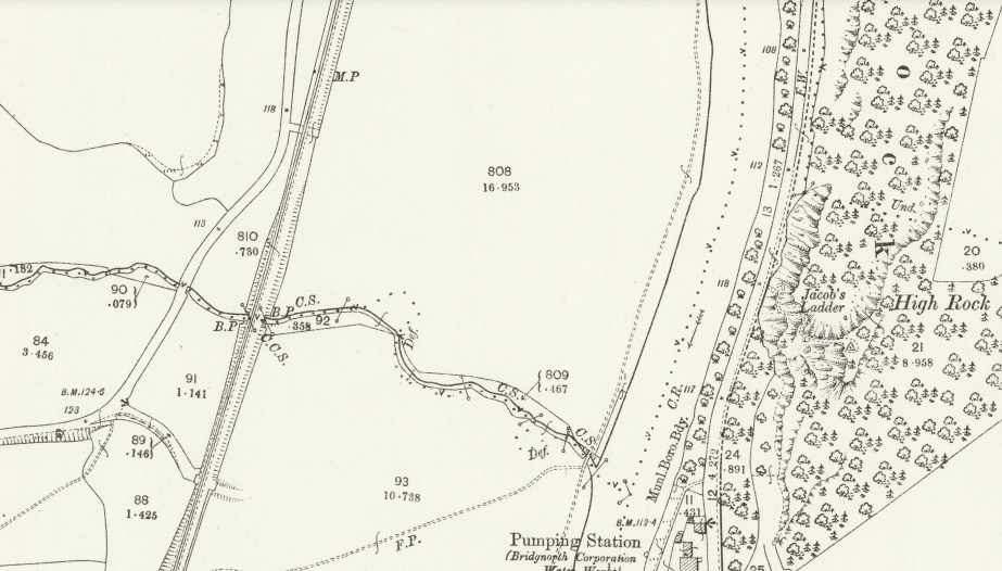
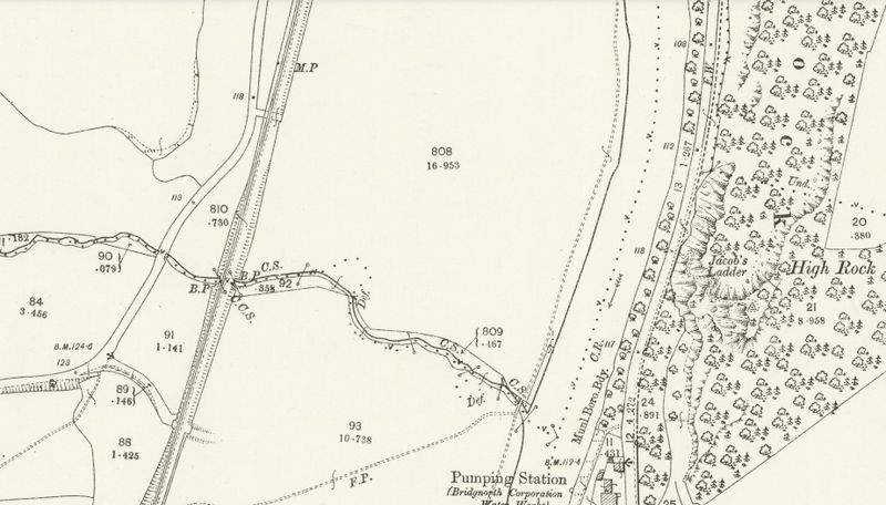
The Old Regatta Ground, north of Bridgnorth, site of the 1896 Shropshire and West Midlands Agricultural Show. The wider embankment by field 808 identifies the location of the temporary siding.
Licencing
This image is derived from an original Ordnance Survey Map held on the National Library of Scotland Map Images Website.
Reproduced with the permission of the National Library of Scotland under the terms of the Creative Commons Attribution-NonCommercial-ShareAlike (CC-BY-NC-SA) licence.
File history
Click on a date/time to view the file as it appeared at that time.
| Date/Time | Thumbnail | Dimensions | User | Comment | |
|---|---|---|---|---|---|
| current | 21:53, 10 December 2021 | | 923 × 526 (176 KB) | Graham Phillips 110 (talk | contribs) | The Old Regatta Ground, north of Bridgnorth, site of the 1896 Shropshire and West Midlands Agricultural Show. The wider embankment by field 808 identifies the location of the temporary siding. |
- You cannot overwrite this file.
File usage
The following page links to this file: