Difference between revisions of "File:Bridgnorth and Hartlebury deviations 1855.jpg"
From SVR Wiki
(1855 plan of the proposed deviations at Hartlebury and Bridgnorth. Also showing variant spellings of "Bridgenorth", "Hampton Load", "Higley" and "Knoll Sands". A larger version of this map can be viewed at [https://i.postimg.cc/nF3Vz2V1/BA-338-b161-183...) |
(→Summary: add line break) |
||
| Line 1: | Line 1: | ||
== Summary == | == Summary == | ||
1855 plan of the proposed deviations at Hartlebury and Bridgnorth. Also showing variant spellings of "Bridgenorth", "Hampton Load", "Higley" and "Knoll Sands". | 1855 plan of the proposed deviations at Hartlebury and Bridgnorth. Also showing variant spellings of "Bridgenorth", "Hampton Load", "Higley" and "Knoll Sands". | ||
| − | A larger version of this map can be viewed at [https://i.postimg.cc/nF3Vz2V1/BA-338-b161-183-2.jpg | + | |
| + | A larger version of this map can be viewed at [https://i.postimg.cc/nF3Vz2V1/BA-338-b161-183-2.jpg Hartlebury and Bridgnorth deviations 7263x9462] (21MB. May be slow to load) | ||
| + | |||
== Licencing == | == Licencing == | ||
{{PD-author}} | {{PD-author}} | ||
Latest revision as of 11:06, 12 August 2021
Summary
1855 plan of the proposed deviations at Hartlebury and Bridgnorth. Also showing variant spellings of "Bridgenorth", "Hampton Load", "Higley" and "Knoll Sands".
A larger version of this map can be viewed at Hartlebury and Bridgnorth deviations 7263x9462 (21MB. May be slow to load)
Licencing
This work has been (or is hereby) released into the public domain by the copyright holder. This applies worldwide.
In case this is not legally possible,
The copyright holder grants any entity the right to use this work for any purpose, without any conditions, unless such conditions are required by law.
File history
Click on a date/time to view the file as it appeared at that time.
| Date/Time | Thumbnail | Dimensions | User | Comment | |
|---|---|---|---|---|---|
| current | 11:05, 12 August 2021 | 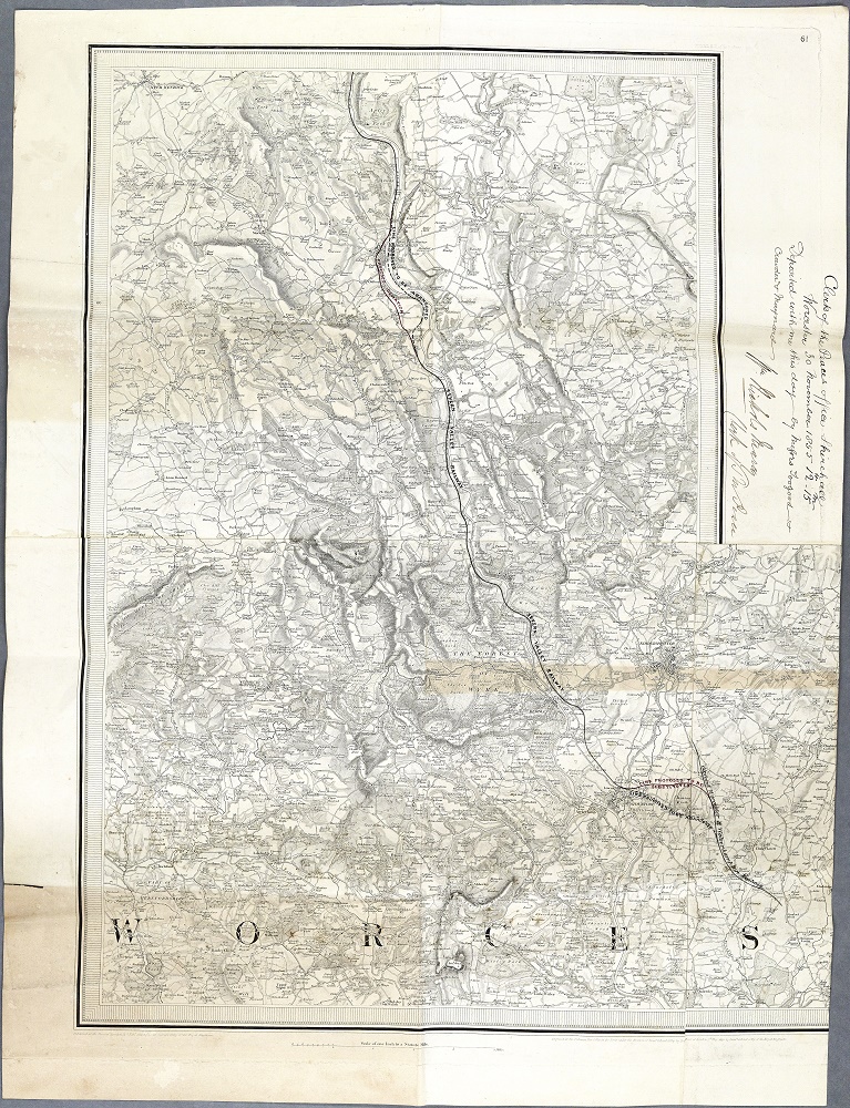 | 767 × 1,000 (480 KB) | Graham Phillips 110 (talk | contribs) | 1855 plan of the proposed deviations at Hartlebury and Bridgnorth. Also showing variant spellings of "Bridgenorth", "Hampton Load", "Higley" and "Knoll Sands". A larger version of this map can be viewed at [https://i.postimg.cc/nF3Vz2V1/BA-338-b161-183... |
- You cannot overwrite this file.
File usage
The following page links to this file: