Size of this preview: 800 × 435 pixels. Other resolutions: 320 × 174 pixels | 976 × 531 pixels.
Original file (976 × 531 pixels, file size: 116 KB, MIME type: image/jpeg)
Summary
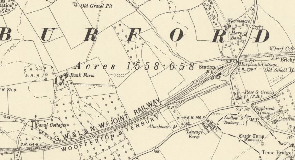
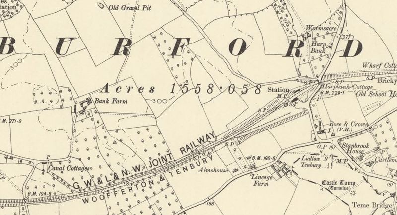
Ordnance Survey Map, 1888-1913 series, showing Tenbury Wells Station
Licencing
This image is derived from an original Ordnance Survey Map held on the National Library of Scotland Map Images Website.
Reproduced with the permission of the National Library of Scotland under the terms of the Creative Commons Attribution-NonCommercial-ShareAlike (CC-BY-NC-SA) licence.
File history
Click on a date/time to view the file as it appeared at that time.
| Date/Time | Thumbnail | Dimensions | User | Comment | |
|---|---|---|---|---|---|
| current | 16:41, 19 November 2015 | | 976 × 531 (116 KB) | Robin (talk | contribs) | Ordnance Survey Map, 1888-1913 series, showing Tenbury Wells Station |
- You cannot overwrite this file.
File usage
The following page links to this file: