File:Woofferton Signalbox - geograph.org.uk - 1746101.jpg
From SVR Wiki

Size of this preview: 450 × 600 pixels. Other resolutions: 180 × 240 pixels | 480 × 640 pixels.
Original file (480 × 640 pixels, file size: 222 KB, MIME type: image/jpeg)
Summary
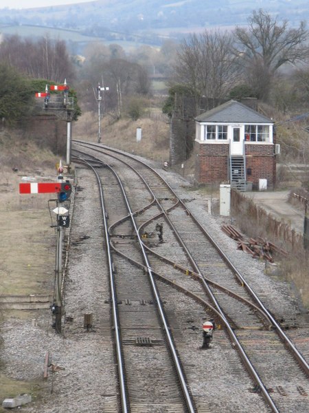
| Description |
English: Woofferton Signalbox One of several similar designs unique to the "North & West" route. Before 1961, the branch to Tenbury Wells and Bewdley passed to the right of the signalbox. Beyond the dismantled farm accommodation bridge there is a loop on the up side, the signal for which is visible in the distance. A parallel down loop also existed at one time. |
| Date | |
| Source | From geograph.org.uk |
| Author | Whatlep |
| Camera location | | View this and other nearby images on: OpenStreetMap |
|---|
_heading:45.00&language=en-gb)
| Object location | | View this and other nearby images on: OpenStreetMap |
|---|
_heading:45.00&language=en-gb)
Licensing

|
This image was taken from the Geograph project collection. See this photograph's page on the Geograph website for the photographer's contact details. The copyright on this image is owned by Whatlep and is licensed for reuse under the Creative Commons Attribution-ShareAlike 2.0 license.
|
This file is licensed under the Creative Commons Attribution-Share Alike 2.0 Generic licence.
Attribution: Whatlep
- You are free:
- to share – to copy, distribute and transmit the work
- to remix – to adapt the work
- Under the following conditions:
- attribution – You must give appropriate credit, provide a link to the licence, and indicate if changes were made. You may do so in any reasonable manner, but not in any way that suggests the licensor endorses you or your use.
- share alike – If you remix, transform, or build upon the material, you must distribute your contributions under the same or compatible licence as the original.
File history
Click on a date/time to view the file as it appeared at that time.
| Date/Time | Thumbnail | Dimensions | User | Comment | |
|---|---|---|---|---|---|
| current | 20:58, 5 March 2011 | | 480 × 640 (222 KB) | GeographBot | == {{int:filedesc}} == {{Information |description={{en|1=Woofferton Signalbox One of several similar designs unique to the "North & West" route. Before 1961, the branch to Tenbury Wells and Bewdley passed to the right of the signalbox. Beyond the disman |
File usage
The following page links to this file: