File:Ironbridge railway station in 1963.jpg
From SVR Wiki
No higher resolution available.
Ironbridge_railway_station_in_1963.jpg (640 × 537 pixels, file size: 112 KB, MIME type: image/jpeg)
Summary
| Description |
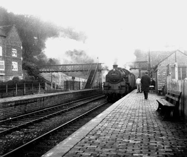
English: Ironbridge station, Shropshire In the days when Ironbridge had a railway, standard class 4 2-6-4T engine 80102 heads an afternoon passenger train from Shrewsbury to Bewdley into Ironbridge station. It is a pity that, when the Severn Valley Railway was restored, the project did not extend far enough to the north to include Ironbridge. |
| Date | Taken on 15 April 1963 |
| Source | From geograph.org.uk |
| Author | Dr Neil Clifton |
| Permission (Reusing this file) |
Creative Commons Attribution Share-alike license 2.0 |
| Camera location | | View this and other nearby images on: OpenStreetMap |
|---|
| Object location | | View this and other nearby images on: OpenStreetMap |
|---|
_region:GB-EAW_heading:270.00&language=en-gb)
Licensing

|
This image was taken from the Geograph project collection. See this photograph's page on the Geograph website for the photographer's contact details. The copyright on this image is owned by Dr Neil Clifton and is licensed for reuse under the Creative Commons Attribution-ShareAlike 2.0 license.
|
This file is licensed under the Creative Commons Attribution-Share Alike 2.0 Generic licence.
Attribution: Dr Neil Clifton
- You are free:
- to share – to copy, distribute and transmit the work
- to remix – to adapt the work
- Under the following conditions:
- attribution – You must give appropriate credit, provide a link to the licence, and indicate if changes were made. You may do so in any reasonable manner, but not in any way that suggests the licensor endorses you or your use.
- share alike – If you remix, transform, or build upon the material, you must distribute your contributions under the same or compatible licence as the original.
File history
Click on a date/time to view the file as it appeared at that time.
| Date/Time | Thumbnail | Dimensions | User | Comment | |
|---|---|---|---|---|---|
| current | 10:02, 1 May 2008 | | 640 × 537 (112 KB) | Edward | w:Ironbridge and Broseley railway station {{geograph|358458|Dr Neil Clifton}} Original description: '''Ironbridge station, Shropshire''' In the days when Ironbridge had a railway, standard class 4 2-6-4T engine 80102 heads an afternoon passenger t |
File usage
The following page links to this file: