Difference between revisions of "Staffordshire & Worcestershire Canal"
(additional info and history) |
(featured article) |
||
| Line 1: | Line 1: | ||
| − | + | [[File:Stourport Canal Bridge 20201107.jpg||thumb|300px|right| The Staffordshire & Worcestershire Canal at Mitton Railway Bridge, Stourport]] | |
[[File:Viaduct - geograph.org.uk - 499261.jpg|thumb|300px|right| The Staffordshire & Worcestershire Canal at Falling Sands Viaduct]] | [[File:Viaduct - geograph.org.uk - 499261.jpg|thumb|300px|right| The Staffordshire & Worcestershire Canal at Falling Sands Viaduct]] | ||
| − | + | The Severn Valley Railway crossed over the '''Staffordshire & Worcestershire Canal''' at Stourport, with a canal basin being built in the 1880s to provide a connection to the railway. The [[Kidderminster Loop Line]] also crosses over the canal at [[Falling Sands Viaduct]]. | |
| − | The 46 mile | + | ==Early history== |
| + | The 46 mile Staffordshire & Worcestershire Canal, known locally as the 'Staffs & Worcs', was promoted mainly by Wolverhampton businessmen and it received its Act on 14 May 1766. James Brindley was appointed surveyor. It first opened in 1771 and was completed the following year, linking the Trent and Mersey Canal<ref group="note">The Trent and Mersey Canal received its Act on the same day as the Staffordshire & Worcestershire</ref> in Staffordshire with [[Stourport]] in Worcestershire.<ref>[https://en.wikipedia.org/wiki/Staffordshire_and_Worcestershire_Canal The Staffordshire & Worcestershire Canal on Wikipedia]</ref><ref>[https://canalrivertrust.org.uk/enjoy-the-waterways/canal-and-river-network/staffordshire-and-worcestershire-canal 'Staffordshire & Worcestershire Canal', Canal and River Trust] (Retrieved 9 November 2020)</ref> | ||
| − | + | At its north end the canal begins at Heywood Junction on the Trent and Mersey Canal, close to the Shugborough Estate, a few miles east of Stafford. It initially runs west toward Stafford before turning south on the outskirts of the town. It then travels south through Penkridge, running close to the present day M6 between Junctions 13 and 12. South of the present day M54 it passes between Fordhouses and Pendeford and then to the west of Wolverhampton. Continuing south, it passes through Wombourne before meeting and crossing over the [[River Stour]] near Prestwood in Staffordshire. From there it follows the river's east bank through the villages of Stourton and Kinver (Staffordshire) and Caunsall, Cookley and Wolverley (Worcestershire). At [[Kidderminster]] the canal crosses back over the river to its west bank which it then follows to the south to meet with the River Severn at Stourport. | |
| − | + | In 1771 John Wesley described Stourport as a "well-built village", but following the opening of the canal for trade in 1772 the village quickly grew into a town based around the large canal basins that served as the 'port', reaching a population of 1,300 by 1795.<ref>[https://en.wikipedia.org/wiki/Stourport-on-Severn Stourport on Wikipedia]</ref> The early growth of Stourport saw a corresponding decline in the fortunes of [[Bewdley]] as a port.<ref>[[Bibliography#Books | Marshall (1989)]] p.12.</ref> Further significant growth of Stourport was effectively ended by the opening of the Worcester and Birmingham Canal in 1816. This provided a direct link between the two towns. | |
| − | + | When the original Severn Valley Railway was built, the route of the railway between Bewdley and Hartlebury required the railway to cross over the canal on the outskirts of [[Stourport]]. [[Stourport Branch#Description_of_the_Stourport_branch|Mitton Railway Bridge]], a segmental skew brick arch of 33ft span was built for that purpose. The construction of the [[Kidderminster Loop Line]] in the 1870s required a second crossing of the canal at [[Falling Sands Viaduct]] near [[Kidderminster]], from which the canal and River Stour can still be seen from passing trains on the present day SVR. | |
| − | + | <gallery mode=packed heights=200px style="text-align:left"> | |
| + | File:Severn and Canal advert 1876.jpg | Severn and Canal Carrying, Shipping, and Steam Towing Co. advertisement from 1876 | ||
| + | </gallery> | ||
| − | + | ==Stourport station canal basin and interchange sidings== | |
| + | An ironworks had been established at nearby Wilden in the 17th century, which was connected to the Staffordshire & Worcestershire Canal via the River Stour and a short link canal. By the 1880s its business had grown, leading to the construction of an interchange basin next to Mitton Bridge (the only main line railway/canal interchange throughout the canal) to allow for the delivery of iron and coal via the railway.<ref group="note">The construction of a short branch line to serve the works was apparently not considered.</ref> The cost of the basin was authorised by the GWR Board on 5 March 1884 at an estimated cost of £4,771 and a tender from S.C. Frayne of £1,516 was accepted on 30 July. Construction was finished around the end of February 1885 with basin being filled the following month.<ref name=Marshall89>[[Bibliography#Books|Marshall (1989)]] p. 89.</ref> | ||
| + | |||
| + | The interchange sidings were access via a facing junction with the up line just east of the station. A steep descent led to three sidings, two on the north side of the basin and one the south where there was also a goods shed.<ref name=Marshall89/> Much of the early traffic arriving by rail consisted of steel from south Wales and coal from [[Collieries served by the Severn Valley Railway#Highley Colliery|Highley Colliery]], which were transferred by canal to the nearby ironworks at Wilden and Stourvale.<ref>[[Bibliography#Other References|Langford (1974)]] p. 174.</ref> | ||
| − | + | <gallery mode=packed heights=200px style="text-align:left"> | |
| − | <gallery mode=packed heights= | + | File:Stourport1902map.jpg | 1902 map showing the transhipment sidings and basin at Stourport |
| − | File: | + | File:Stourport sidings.jpg | The canal at Stourport, showing the site of the transhipment sidings |
| − | File:Stourport sidings.jpg | The canal at Stourport, showing the site of the | ||
| − | |||
</gallery> | </gallery> | ||
| + | |||
| + | More sidings below the station were approved in 1906 at a cost of £1,273. In 1912 a one-ton crane was installed at the basin. | ||
| + | |||
| + | After [[Stourport Power Station]] opened in 1927, coal for its use was brought via the canal from the Cannock coalfield (through which the canal's route passed), this traffic being nicknamed the 'Light Run'. Among the largest collieries involved in the Light Run were the Littleton colliery at Cannock, Baggeridge colliery at Sedgley, and Cannock Old Coppice colliery at Cheslyn Hay. The coal was taken by barge to a canal basin at Stourport, from where it was transferred to the power station by an aerial ropeway. Initially 100% of the coal used there was transported via this method.<ref>Langford (1974) pp. 66, 133, 180, 196.</ref> | ||
| + | |||
| + | A branch line from [[Stourport|Stourport Station]] was opened in 1940; thereafter coal could be brought in by rail from [[Collieries_served_by_the_Severn_Valley_Railway#Alveley_Colliery | Alveley]] and other local collieries. This route also replaced the ‘Light Run’ as the method of bringing coal from the Cannock area; by 1949 only 5% of the coal used arrived by water.<ref>Langford (1974) p. 66.</ref> Instructions for working the sidings at the canal basins remained in the sectional appendix to the working timetable as late as 1960, although by then there can have been little or no traffic using them.<ref name=Marshall89/> | ||
| + | |||
| + | Unlike many other canals, the Staffordshire and Worcestershire Canal was never sold or leased to a railway company, staying independent until nationalisation in 1948 under the British Transport Commission, the Docks and Inland Waterways Executive and later the British Waterways Board. In July 2012, along with the rest of British Waterways' assets in England and Wales, it transferred to the newly formed charitable Canal & River Trust. | ||
==See also== | ==See also== | ||
| − | [[River Stour]] | + | *[[River Stour]] |
| + | |||
| + | ==Notes== | ||
| + | <references group="note"/> | ||
==References== | ==References== | ||
| Line 29: | Line 44: | ||
==Links== | ==Links== | ||
| − | [https://drive.google.com/file/d/0B2eAFhE-m0yhNkhfMGVVSHVCUU0/edit Staffordshire and Worcestershire Canal on the Kidderminster & District Archaeological & Historical Society web site] | + | *[https://drive.google.com/file/d/0B2eAFhE-m0yhNkhfMGVVSHVCUU0/edit Staffordshire and Worcestershire Canal on the Kidderminster & District Archaeological & Historical Society web site] |
| − | [https://drive.google.com/file/d/0B2eAFhE-m0yhZXY5aHUxdmNpQlk/edit Kidderminster Canal Wharfs on the Kidderminster & District Archaeological & Historical Society web site]<br> | + | *[https://drive.google.com/file/d/0B2eAFhE-m0yhZXY5aHUxdmNpQlk/edit Kidderminster Canal Wharfs on the Kidderminster & District Archaeological & Historical Society web site]<br> |
| − | [https://canalrivertrust.org.uk/enjoy-the-waterways/canal-and-river-network/staffordshire-and-worcestershire-canal 'Staffordshire & Worcestershire Canal', Canal and River Trust] | + | *[https://canalrivertrust.org.uk/enjoy-the-waterways/canal-and-river-network/staffordshire-and-worcestershire-canal 'Staffordshire & Worcestershire Canal', Canal and River Trust] |
| − | {{#coordinates:52.373358|-2.252735|[primary|][dim:1000]}} | + | {{#coordinates:52.373358|-2.252735|[primary|][dim:1000]}} |
| + | [[Category:Featured articles]] | ||
Revision as of 15:59, 8 November 2021


The Severn Valley Railway crossed over the Staffordshire & Worcestershire Canal at Stourport, with a canal basin being built in the 1880s to provide a connection to the railway. The Kidderminster Loop Line also crosses over the canal at Falling Sands Viaduct.
Early history
The 46 mile Staffordshire & Worcestershire Canal, known locally as the 'Staffs & Worcs', was promoted mainly by Wolverhampton businessmen and it received its Act on 14 May 1766. James Brindley was appointed surveyor. It first opened in 1771 and was completed the following year, linking the Trent and Mersey Canal[note 1] in Staffordshire with Stourport in Worcestershire.[1][2]
At its north end the canal begins at Heywood Junction on the Trent and Mersey Canal, close to the Shugborough Estate, a few miles east of Stafford. It initially runs west toward Stafford before turning south on the outskirts of the town. It then travels south through Penkridge, running close to the present day M6 between Junctions 13 and 12. South of the present day M54 it passes between Fordhouses and Pendeford and then to the west of Wolverhampton. Continuing south, it passes through Wombourne before meeting and crossing over the River Stour near Prestwood in Staffordshire. From there it follows the river's east bank through the villages of Stourton and Kinver (Staffordshire) and Caunsall, Cookley and Wolverley (Worcestershire). At Kidderminster the canal crosses back over the river to its west bank which it then follows to the south to meet with the River Severn at Stourport.
In 1771 John Wesley described Stourport as a "well-built village", but following the opening of the canal for trade in 1772 the village quickly grew into a town based around the large canal basins that served as the 'port', reaching a population of 1,300 by 1795.[3] The early growth of Stourport saw a corresponding decline in the fortunes of Bewdley as a port.[4] Further significant growth of Stourport was effectively ended by the opening of the Worcester and Birmingham Canal in 1816. This provided a direct link between the two towns.
When the original Severn Valley Railway was built, the route of the railway between Bewdley and Hartlebury required the railway to cross over the canal on the outskirts of Stourport. Mitton Railway Bridge, a segmental skew brick arch of 33ft span was built for that purpose. The construction of the Kidderminster Loop Line in the 1870s required a second crossing of the canal at Falling Sands Viaduct near Kidderminster, from which the canal and River Stour can still be seen from passing trains on the present day SVRSevern Valley Railway.
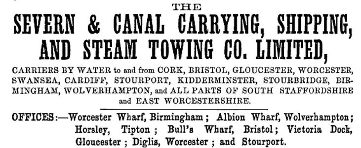
Severn and Canal Carrying, Shipping, and Steam Towing Co. advertisement from 1876

Stourport station canal basin and interchange sidings
An ironworks had been established at nearby Wilden in the 17th century, which was connected to the Staffordshire & Worcestershire Canal via the River Stour and a short link canal. By the 1880s its business had grown, leading to the construction of an interchange basin next to Mitton Bridge (the only main line railway/canal interchange throughout the canal) to allow for the delivery of iron and coal via the railway.[note 2] The cost of the basin was authorised by the GWRGreat Western Railway Board on 5 March 1884 at an estimated cost of £4,771 and a tender from S.C. Frayne of £1,516 was accepted on 30 July. Construction was finished around the end of February 1885 with basin being filled the following month.[5]
The interchange sidings were access via a facing junction with the up line just east of the station. A steep descent led to three sidings, two on the north side of the basin and one the south where there was also a goods shed.[5] Much of the early traffic arriving by rail consisted of steel from south Wales and coal from Highley Colliery, which were transferred by canal to the nearby ironworks at Wilden and Stourvale.[6]

1902 map showing the transhipment sidings and basin at Stourport

The canal at Stourport, showing the site of the transhipment sidings


More sidings below the station were approved in 1906 at a cost of £1,273. In 1912 a one-ton crane was installed at the basin.
After Stourport Power Station opened in 1927, coal for its use was brought via the canal from the Cannock coalfield (through which the canal's route passed), this traffic being nicknamed the 'Light Run'. Among the largest collieries involved in the Light Run were the Littleton colliery at Cannock, Baggeridge colliery at Sedgley, and Cannock Old Coppice colliery at Cheslyn Hay. The coal was taken by barge to a canal basin at Stourport, from where it was transferred to the power station by an aerial ropeway. Initially 100% of the coal used there was transported via this method.[7]
A branch line from Stourport Station was opened in 1940; thereafter coal could be brought in by rail from Alveley and other local collieries. This route also replaced the ‘Light Run’ as the method of bringing coal from the Cannock area; by 1949 only 5% of the coal used arrived by water.[8] Instructions for working the sidings at the canal basins remained in the sectional appendix to the working timetable as late as 1960, although by then there can have been little or no traffic using them.[5]
Unlike many other canals, the Staffordshire and Worcestershire Canal was never sold or leased to a railway company, staying independent until nationalisation in 1948 under the British Transport Commission, the Docks and Inland Waterways Executive and later the British Waterways Board. In July 2012, along with the rest of British Waterways' assets in England and Wales, it transferred to the newly formed charitable Canal & River Trust.
See also
Notes
- ↑ The Trent and Mersey Canal received its Act on the same day as the Staffordshire & Worcestershire
- ↑ The construction of a short branch line to serve the works was apparently not considered.
References
- ↑ The Staffordshire & Worcestershire Canal on Wikipedia
- ↑ 'Staffordshire & Worcestershire Canal', Canal and River Trust (Retrieved 9 November 2020)
- ↑ Stourport on Wikipedia
- ↑ Marshall (1989) p.12.
- ↑ 5.0 5.1 5.2 Marshall (1989) p. 89.
- ↑ Langford (1974) p. 174.
- ↑ Langford (1974) pp. 66, 133, 180, 196.
- ↑ Langford (1974) p. 66.