Difference between revisions of "Geographic Map"
From SVR Wiki
(Created page with "File:Svrline-stat2.jpg") |
|||
| (One intermediate revision by the same user not shown) | |||
| Line 1: | Line 1: | ||
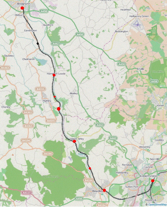
| − | + | Click on any station or station name to go to that station's page. | |
| + | <br> | ||
| + | <imagemap> | ||
| + | Image:Svrline-stat2.jpg | ||
| + | rect 50 5 105 20 [[Bridgnorth]] | ||
| + | circle 74 27 10 [[Bridgnorth]] | ||
| + | rect 75 92 130 107 [[Eardington]] | ||
| + | circle 124 144 10 [[Eardington]] | ||
| + | rect 140 235 225 250 [[Hampton Loade]] | ||
| + | circle 180 317 10 [[Country Park Halt]] | ||
| + | rect 130 325 180 340 [[Highley]] | ||
| + | circle 194 358 10 [[Highley]] | ||
| + | rect 225 450 280 465 [[Arley]] | ||
| + | circle 245 465 10 [[Arley]] | ||
| + | circle 296 555 10 [[Northwood Halt]] | ||
| + | rect 300 620 350 635 [[Bewdley]] | ||
| + | rect 455 570 520 585 [[Kidderminster]] | ||
| + | circle 504 596 10 [[Kidderminster]] | ||
| + | </imagemap> | ||
Latest revision as of 18:24, 23 January 2015
Click on any station or station name to go to that station's page.