File:OS Cound 1965.jpg
From SVR Wiki
Size of this preview: 800 × 447 pixels. Other resolutions: 320 × 179 pixels | 1,200 × 670 pixels.
Original file (1,200 × 670 pixels, file size: 402 KB, MIME type: image/jpeg)
Summary
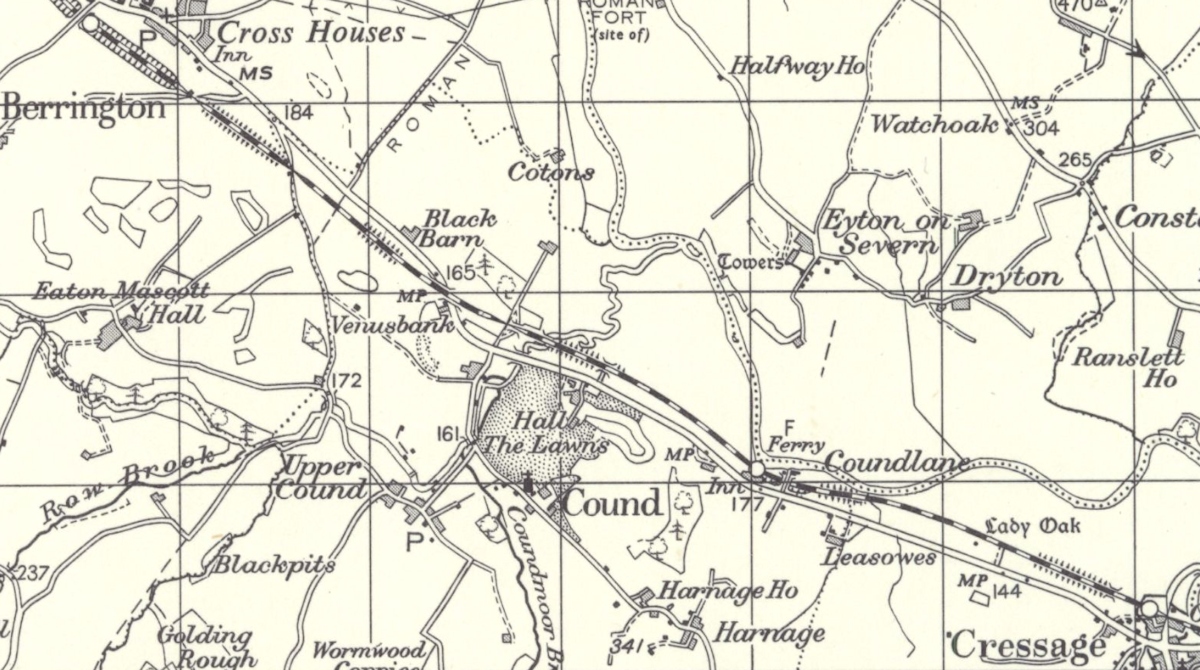
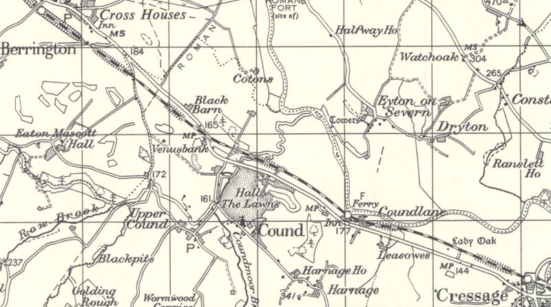
OSOrdnance Survey 1 inch Map printed circa 1965 but surveyed several years earlier, showing the location of Cound Halt and the nearby settlements.
Licencing
This image is derived from an original Ordnance Survey Map held on the National Library of Scotland Map Images Website.
Reproduced with the permission of the National Library of Scotland under the terms of the Creative Commons Attribution-NonCommercial-ShareAlike (CC-BY-NC-SA) licence.
File history
Click on a date/time to view the file as it appeared at that time.
| Date/Time | Thumbnail | Dimensions | User | Comment | |
|---|---|---|---|---|---|
| current | 14:42, 6 September 2021 | | 1,200 × 670 (402 KB) | Robin (talk | contribs) | OS 1 inch Map printed circa 1965 but surveyed several years earlier, showing the location of Cound Halt and the nearby settlements. |
- You cannot overwrite this file.
File usage
The following page links to this file: