File:Hartlebury Brick Works 1927.jpg
From SVR Wiki
Revision as of 23:14, 26 December 2022 by Graham Phillips 110 (talk | contribs) (1927 map of Hartlebury Brick Works showing the siding and wharf. == Licencing == {{National Library of Scotland OS Map}})
Size of this preview: 624 × 599 pixels. Other resolutions: 250 × 240 pixels | 803 × 771 pixels.
Original file (803 × 771 pixels, file size: 198 KB, MIME type: image/jpeg)
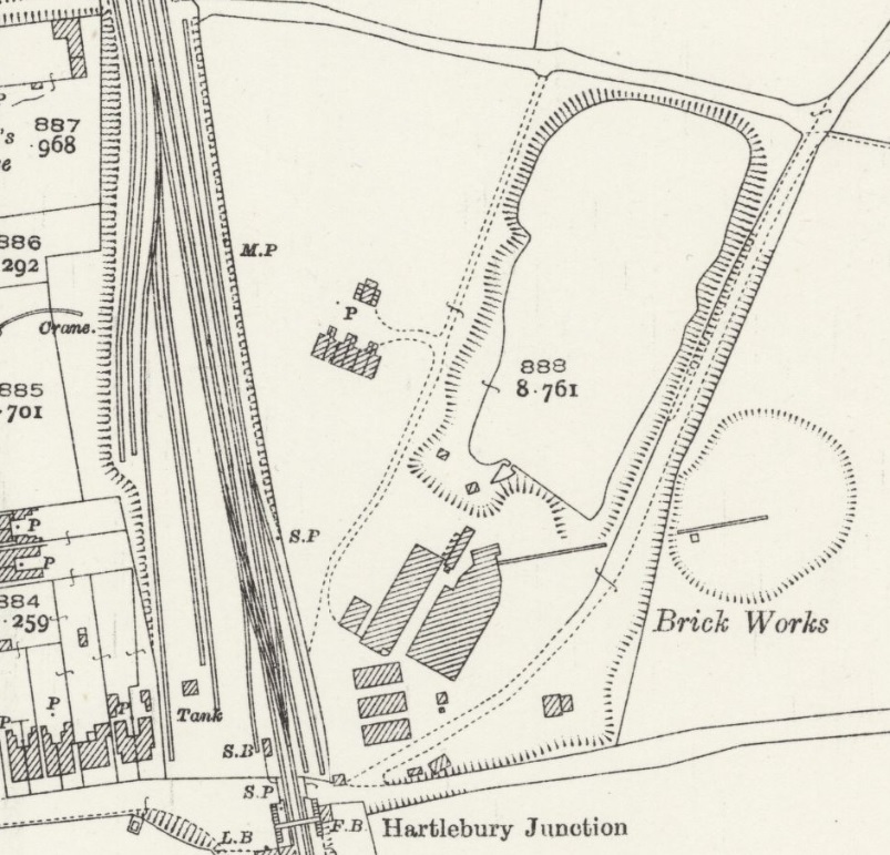
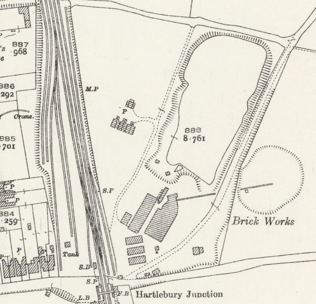
1927 map of Hartlebury Brick Works showing the siding and wharf.
Licencing
This image is derived from an original Ordnance Survey Map held on the National Library of Scotland Map Images Website.
Reproduced with the permission of the National Library of Scotland under the terms of the Creative Commons Attribution-NonCommercial-ShareAlike (CC-BY-NC-SA) licence.
File history
Click on a date/time to view the file as it appeared at that time.
| Date/Time | Thumbnail | Dimensions | User | Comment | |
|---|---|---|---|---|---|
| current | 23:14, 26 December 2022 | | 803 × 771 (198 KB) | Graham Phillips 110 (talk | contribs) | 1927 map of Hartlebury Brick Works showing the siding and wharf. == Licencing == {{National Library of Scotland OS Map}} |
- You cannot overwrite this file.
File usage
The following page links to this file: