File:Rifle Range OS Map.jpg
From SVR Wiki

No higher resolution available.
Rifle_Range_OS_Map.jpg (683 × 549 pixels, file size: 153 KB, MIME type: image/jpeg)
Extract from the Ordnance Survey Map of 1888-1929 showing the location of the Rifle Range and its halt near Bewdley.
Licencing
This image is derived from an original Ordnance Survey Map held on the National Library of Scotland Map Images Website.
Reproduced with the permission of the National Library of Scotland under the terms of the Creative Commons Attribution-NonCommercial-ShareAlike (CC-BY-NC-SA) licence.
File history
Click on a date/time to view the file as it appeared at that time.
| Date/Time | Thumbnail | Dimensions | User | Comment | |
|---|---|---|---|---|---|
| current | 12:02, 13 December 2015 | | 683 × 549 (153 KB) | Danny252 (talk | contribs) | Change map to 1888-1929 map, which shows halt |
| 15:23, 30 June 2015 | 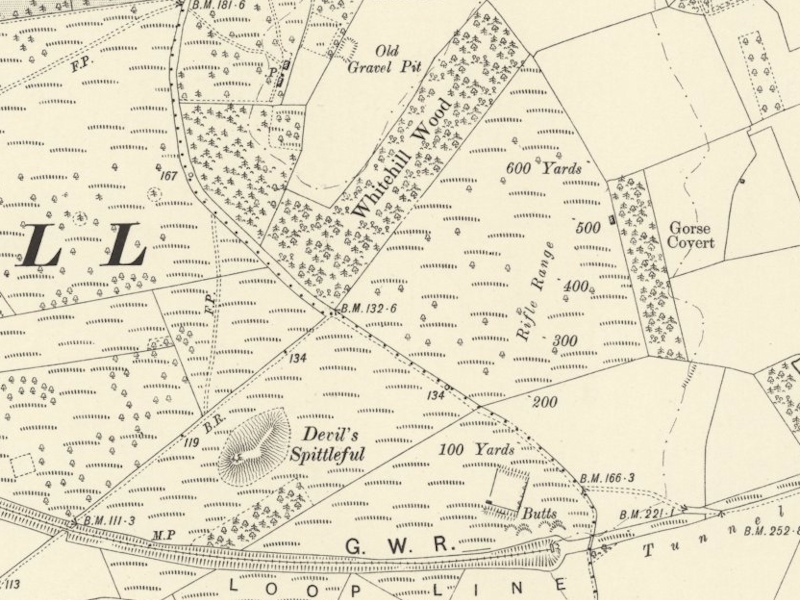 | 800 × 600 (231 KB) | Robin (talk | contribs) | Extract from the Ordnance Survey Map of 1888-1913 showing the location of the Rifle Range near Bewdley. (Crown Copyright reserved) |
- You cannot overwrite this file.
File usage
The following page links to this file: