File:OS Wilden 1927.jpg
From SVR Wiki
Size of this preview: 800 × 335 pixels. Other resolutions: 320 × 134 pixels | 1,200 × 502 pixels.
Original file (1,200 × 502 pixels, file size: 95 KB, MIME type: image/jpeg)
Summary
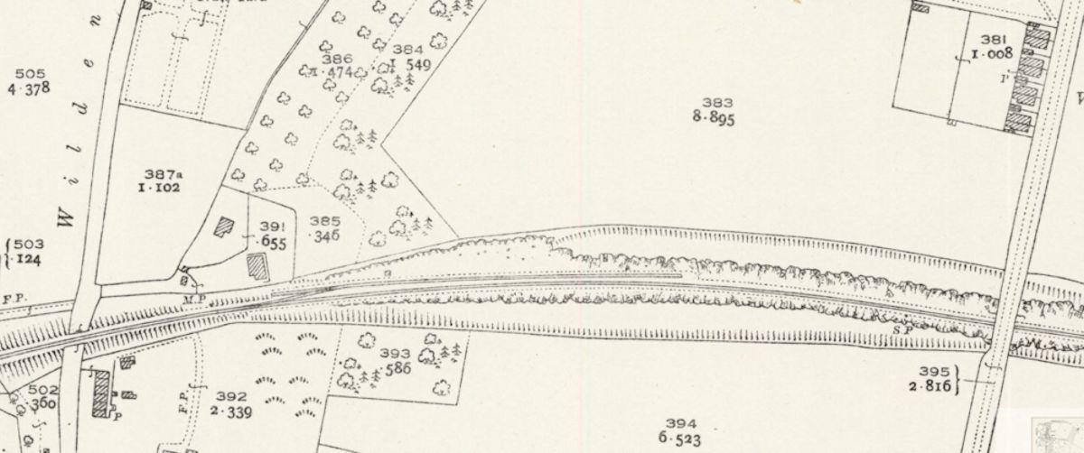
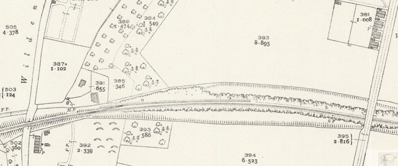
Extract from the OSOrdnance Survey 25in map of Worcestershire XIV.11 (Hartlebury; Stourport on Severn), Revised 1925, Published 1927, showing the layout and extent of Wilden Sand Siding. Wilden Lane to the west, Wilden Top Road to the east.
Licencing
This image is derived from an original Ordnance Survey Map held on the National Library of Scotland Map Images Website.
Reproduced with the permission of the National Library of Scotland under the terms of the Creative Commons Attribution-NonCommercial-ShareAlike (CC-BY-NC-SA) licence.
File history
Click on a date/time to view the file as it appeared at that time.
| Date/Time | Thumbnail | Dimensions | User | Comment | |
|---|---|---|---|---|---|
| current | 19:30, 7 May 2021 | | 1,200 × 502 (95 KB) | Robin (talk | contribs) | Extract from the OS 25in map of Worcestershire XIV.11 (Hartlebury; Stourport on Severn), Revised 1925, Published 1927, showing the layout and extent of Wilden Sand Siding. Wilden Lane to the west, Wilden Top Road to the east. |
- You cannot overwrite this file.
File usage
The following page links to this file: