File:OS Map Coalport Siding.JPG
From SVR Wiki

Size of this preview: 704 × 600 pixels. Other resolutions: 282 × 240 pixels | 783 × 667 pixels.
Original file (783 × 667 pixels, file size: 139 KB, MIME type: image/jpeg)
Summary
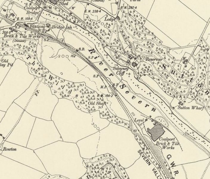
Ordnance Survey map published 1903, showing Coalport Brick & Tile Works siding
Licencing
This image is derived from an original Ordnance Survey Map held on the National Library of Scotland Map Images Website.
Reproduced with the permission of the National Library of Scotland under the terms of the Creative Commons Attribution-NonCommercial-ShareAlike (CC-BY-NC-SA) licence.
File history
Click on a date/time to view the file as it appeared at that time.
| Date/Time | Thumbnail | Dimensions | User | Comment | |
|---|---|---|---|---|---|
| current | 22:05, 7 December 2015 | | 783 × 667 (139 KB) | Robin (talk | contribs) | Ordnance Survey map published 1903, showing Coalport Brick & Tile Works siding |
- You cannot overwrite this file.
File usage
There are no pages that link to this file.