File:BritainFromAbove StourportWide 1948.jpg
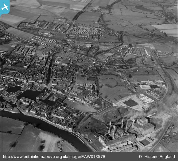
An aerial view of Stourport, dated 9 March 1948. The River Severn is at the bottom left, with Stourport Power Station bottom right. The exchange sidings extend up the right hand side of the frame, meeting the SVRSevern Valley Railway which crosses left to right at the top of the image, Stourport station being top centre by the level crossing. The large white building north of the line a short distance west of the station is the World War 2 emergency silo and food store for which sidings were provided in 1941. Note also the extensive canal basins on the Staffs and Worcs canal.
Image from Britain from Above, released for free non-commercial use. See source for further details on licensing.
File history
Click on a date/time to view the file as it appeared at that time.
| Date/Time | Thumbnail | Dimensions | User | Comment | |
|---|---|---|---|---|---|
| current | 20:59, 17 December 2015 | | 580 × 523 (65 KB) | Danny252 (talk | contribs) | An aerial view of Stourport, dated 9 March 1948. The River Severn is at the bottom left, with Stourport Power Station bottom right. The exchange sidings extend up the right hand side of the frame, meeting the SVR which crosses left to right at the top... |
- You cannot overwrite this file.
File usage
The following 3 pages link to this file: