File:Bridgnorth turntable plan.png
From SVR Wiki
No higher resolution available.
Bridgnorth_turntable_plan.png (755 × 366 pixels, file size: 232 KB, MIME type: image/png)
Summary
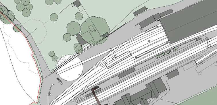
Site plan from application Planning Application 16/00156/FUL including the turntable, situated to the South-East of Hanbury Cottage.
Licencing
This work has been (or is hereby) released into the public domain by the copyright holder. This applies worldwide.
In case this is not legally possible,
The copyright holder grants any entity the right to use this work for any purpose, without any conditions, unless such conditions are required by law.
File history
Click on a date/time to view the file as it appeared at that time.
| Date/Time | Thumbnail | Dimensions | User | Comment | |
|---|---|---|---|---|---|
| current | 22:09, 25 November 2017 | | 755 × 366 (232 KB) | Patrick Hearn (talk | contribs) | Site plan from application Planning Application 16/00156/FUL including the turntable, situated to the South-East of Hanbury Cottage. |
- You cannot overwrite this file.
File usage
The following page links to this file: